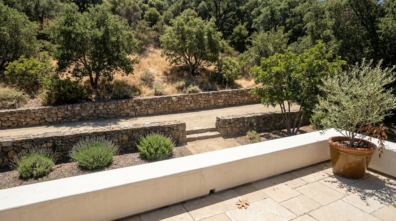
Los Penasquitos Canyon Trail Conditions in Carmel Valley
August 27, 2026
August 27, 2026
An Extreme Heat Watch goes into effect for San Diego on Tuesday, August 25, running through Friday evening, August 28, according to the city's own alert page for Los Peñasquitos Canyon Preserve. For most of the county that means adjusting a jog time. For Carmel Valley, it lands on top of a fire closure that's been posted since June, and the two together have a way of making people assume more of the canyon is off-limits than actually is.
Here's the part that gets lost: the closure isn't the whole east end of the preserve. It's one specific loop. The trail most Carmel Valley residents already walk from the Black Mountain Road side is still open. So is the loop most residents walk from the Carmel Valley side. What's closed is a narrower, flatter route out to the historic adobe, and knowing that difference before you drive out during a heat watch is worth more than the generic "bring water" advice every trail app repeats.
The Rancho Peñasquitos Adobe Loop, a flat 3.2-mile walk that leads straight to the Santa María de Los Peñasquitos Adobe, built around 1823, has carried an active fire closure since June 2026. AllTrails still lists the route, tagged closed, with no reopening date attached.
That's the trail people mean when they say "the canyon is closed." It isn't. The Los Penasquitos Canyon Trail, the longer 6.9-mile route that most hikers and mountain bikers actually use from the Black Mountain Road staging area, carries no such flag and was confirmed current as recently as August 18. The Peñasquitos Falls Loop entered from the Carmel Valley side, a 2.8-mile route down to the waterfall with no parking fee, is open as well.
So the honest map of this week looks less like "east end closed, west end open" and more like this:
| Trail | Typical entry point | Status this week |
|---|---|---|
| Peñasquitos Falls Loop | Carmel Valley residential trailhead | Open |
| Los Penasquitos Canyon Trail | Black Mountain Road staging area | Open, confirmed August 18 |
| Rancho Peñasquitos Adobe Loop | Near the Adobe, off Black Mountain Road | Closed since June 2026, fire risk |
If you want to see the adobe itself without the closed loop, there's a workaround. The county-operated Adobe is reached by car via Canyonside Park Driveway rather than the trail, and the volunteer group that supports the preserve lists guided tours of the residence, one of San Diego's oldest standing structures, on Saturdays at 11 a.m. and Sundays at 1 p.m. The walking route may be shut. The building isn't.
Along the open Canyon Trail, hikers pass the Ranch House Crossing and, a short distance later, a marked sign for Eichar's Grave, the resting place of a ranch cook named John Eichar. It's a small, specific detail buried in an otherwise unremarkable stretch of dirt road, and it's one of the reasons this canyon rewards people who walk it repeatedly rather than once.
Keep going and you'll reach the waterfall itself, a cascade running over a shelf of volcanic rock. Every account of this trail agrees on one point: the falls run best after rain and thin out considerably in the dry months. Late August, after a full summer without meaningful rainfall, is exactly the stretch where the cascade that photographs well in February looks more like a damp rock face than a waterfall. That's not a reason to skip the walk. It's a reason to reset the expectation before you bring a first-timer who's heard about "the falls" and is picturing something bigger than what's actually running.
The creek itself still moves, the sycamore and oak canopy along the banks still throws real shade, and Carson's Crossing, a small footbridge along the way, remains one of the better rest stops on the route no matter how much water is coming over the rocks.
A heat watch isn't a closure, but it should change which part of the trail you choose. The creekside single-track that runs between the water and the wider dirt road holds up far better in high heat than the open sections of trail, which turn sunny and largely unshaded once you're a half mile or so past the trailhead.
If you're walking this week, favor the shaded creek-adjacent path over the exposed utility road, start before the heat sets in if you can, and save the more exposed stretches for a cooler month. None of that is exotic advice. It's the version of "check conditions" that accounts for the fact that this preserve holds two very different microclimates depending on which stretch of trail you're standing on.
Carmel Valley has two fenced, off-leash alternatives nearby, and they're different enough from each other to be worth knowing both.
The dog park behind the Torrey Hills shopping center on Carmel Mountain Road is flat, fully fenced, and surfaced in decomposed granite with a water fountain on site. It's the low-effort option for an evening visit when the goal is letting a dog run without much walking on your own part.
Torrey Highlands Dog Park sits on a hillside a short drive away and plays differently. The terrain rises and dips instead of sitting flat, there's a gazebo with real seating, and the elevation change means dogs get more of a workout than a flat rectangle offers. It also comes with a view across the surrounding hills that the tree-lined canyon trails don't provide.
Neither replaces the canyon. Both are reasonable substitutes on a day when a heat watch makes several exposed miles a bad idea.
The reason any of this trail network holds together is a volunteer organization most residents drive past without noticing. Friends of Los Peñasquitos Canyon Preserve runs free guided hikes and organizes Sunday restoration parties, and their recent posts show exactly what kind of upkeep this landscape needs right now.
In July, the group published a notice asking hikers not to move oak logs out of the canyon, a direct response to the goldspotted oak borer, an invasive beetle that has been killing oaks across Southern California and spreads in part through firewood and downed branches carried between stands of trees. The same organization documented the planting of Channel Island oaks in the canyon this year as part of restoration work on the preserve's west end, along with a separate grassland restoration project on the Black Mountain Open Space near Santa Luz.
None of that shows up on a trail map. It's the reason the canopy along the creek trail still exists for residents to walk under during a heat watch, and it's the kind of detail that separates someone who actually uses this preserve from someone who's only seen it listed on a hiking app.
Most weeks, the difference between "one loop is closed" and "the canyon is closed" doesn't matter much. This week, with a heat watch layered on top of a standing fire closure, it's worth getting right before you drive out there expecting a locked gate at every entrance. The trail to the adobe is shut. The trail most people actually walk isn't.
That's the kind of granular, changes-by-the-month knowledge that comes from living alongside a place rather than visiting it once. It's also, not coincidentally, the same instinct that matters when someone is trying to understand a neighborhood for reasons that have nothing to do with hiking. If you're weighing a move within Carmel Valley or just want a conversation with someone who tracks details like these as a matter of course, Danielle Short is a call away. Let's Connect.
Stay up to date on the latest real estate trends.


A Strategic Guide to Setting the Right Home Price in Rancho Santa Fe.
Located in the prestigious village of Rancho Santa Fe, Danielle is a Luxury Estate Specialist, trained in marketing and selling high-end luxury homes. The firm will offer the personal and professional attention you require, all the while maintaining and respecting your privacy and treating your transaction with the utmost integrity.